By the year 1984, it had been completed, and the plan paper had been released. The main goals are as follows:
- The classification of roads into Primary, Secondary, and Tertiary road systems should be used as the foundation for future road development.
- The road network needs to be expanded in order to maintain the rural economy and create small communities with all the amenities they require.
- There should be all-weather roads connecting every village with 500 residents.
- The overall road density has increased to 82 kilometres per 100 square kilometres. To ensure that no region of the nation is more than 50 km from NH, the NH network should be enlarged to create square grids with 100 km of sides.
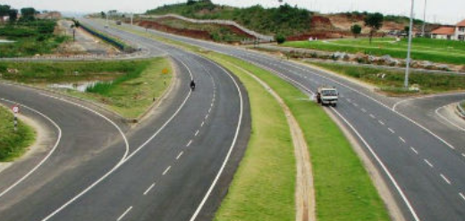
- To allow for quick travel, expressways should be built along key traffic corridors.
- In order to encourage the development of industry, roads should also be constructed in less industrialised areas.
- Road development long-term master plans should be created at various levels.
- Major district roads shall connect all towns and villages with a population of above 1500, and ODR should connect settlements with a population of between 1000 and 1500.
- There should be improvements in environmental quality and road safety.
Length of NH (km) = area of the region/ 50
Length of SH (km)
By area, SH (km) = area of the region/ 25
Based on no. Of towns, SH (km) = 62.5 x no. Of towns – NH
Adopt length of SH (higher of the two criteria)
Length of MDR, in the District a. Based on area, MDR (km) = area of the region/12.5 b.
Based on number of towns, MDR(km) = 90 x number of towns
Provide length of MDR (higher of the two criteria)
Total length of all categories of roads may be assumed to provide an overall density of road length
equal to 82km per 100 sq.km area by the year 2001.
NH + SH + MDR + ODR + VR (km) = area of the region x (82/100)
Therefore length of ODR + VR (km) = Total Length – (NH + SH + MDR)
Lucknow road plan (1981 – 2001) or third 20-year road plan
→ Duration = 1981- 2001
→ Road density = 82 km/100 km²
→ Road pattern = Square grid
→ Length of express ways = 2000 km.
→ Road classification
- Primary system or 1° system = Expressway, National highway
- Secondary system or 2° system = State highway, major district road
- Tertiary system or 3° system = Other district roads, village road.